Computer vision AI and the future of GIS in construction and civil engineering. By Michael Naber
In an era defined by rapid technological advances in computing, built environment industries like construction and civil engineering are in a sweet spot to embrace innovation. One of the most promising technologies being adopted today is Computer Vision, a subfield of Artificial Intelligence (AI), which enables computers to interpret visual data. Paired with Geographic Information Systems (GIS), Computer Vision offers new solutions for managing and auditing asset inventories. This article will explore how Computer Vision AI can be utilized to streamline asset inventory audits, thus ushering the industry into a new age of efficiency and accuracy.
The problem: asset inventory auditing
Asset inventory auditing is a critical – but often cumbersome – process for construction and civil engineering projects. It involves the identification, classification, and documentation of various assets, such as materials, equipment, and structures. Traditional auditing methods, which involve manual, on-site inspections, can be costly and time-consuming. Moreover, human errors, whether in data collection or interpretation, can lead to inaccurate inventory audits, potentially causing significant downstream problems.
 The solution: computer vision AI and GIS integration
Computer Vision AI technology can automate and optimise the inventory auditing process by analyzing images and video data from various sources (i.e., vehicle or drone-mounted cameras), identifying and classifying assets, and noting their condition and location. When integrated with GIS – which is designed to capture, store, and manage geographical data – the technology becomes a powerhouse tool for asset inventory management. Here’s how:
1. Automated asset detection and classification
Computer Vision algorithms can be trained to recognise and categorise a variety of assets based on images or video footage. From power lines to fire hydrants, these algorithms can accurately identify and classify infrastructure assets at a fraction of the time it would take a human auditor.
2. Spatial analysis and georeferencing
With GIS integration, assets identified by Computer Vision can be automatically georeferenced – assigned a specific location on the Earth’s surface. This is vital for spatial GIS analysis, allowing engineers and project managers to visualise and analyse the spatial relationships among various assets.
3. Condition assessment and monitoring
Computer Vision AI can analyse the condition of assets, detecting anomalies such as damage or corrosion. By integrating this data with GIS, organisations can create time-stamped records and documented images of asset conditions, allowing for efficient monitoring and maintenance planning.
4. Streamlined audit reporting
Combining the capabilities of Computer Vision and GIS allows for the generation of comprehensive inventory audit reports. These reports can include various data layers (asset type, condition, location, etc.) in addition to image data, and can be easily shared and analysed by stakeholders at different levels.
5. Unparalleled cost-effectiveness
The integration of Computer Vision AI with GIS technology marks a significant advancement in cost-effectiveness for the construction and civil engineering sectors. Traditional asset inventory auditing often entails manual labour, travel, and time — all of which contribute to escalating costs. The automation enabled by Computer Vision AI dramatically reduces these labour-intensive and time-consuming tasks. Moreover, it eliminates the need for repeated site visits, as high-quality, up-to-date data can be accessed and analysed remotely at any time. The efficiency gains from this integration translate directly into reduced operational costs, enabling firms to allocate resources more strategically. In an industry where the labour force can be stretched thin with competing priorities, the time savings afforded by integrating Computer Vision AI and GIS can be a game-changing advantage for companies and municipalities alike.
Practical applications and case studies
In recent years, several municipalities and engineering firms have begun to integrate Computer Vision AI with GIS for asset inventory audits. For instance:
In urban planning, cities are using vehicle-mounted cameras and AI technology to audit and manage public infrastructure, such as streetlights, benches, and roads. Leveraging this technology can enable proactive maintenance, thereby reducing costs and improving public safety.
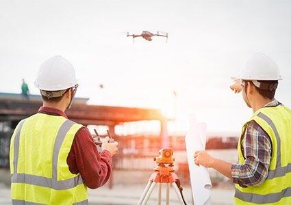
Engineering firms are employing drones to inspect and audit the condition of large civil structures, such as bridges and dams. This technology allows for safer, more efficient audits and is especially useful for assets in hard-to-reach locations.
The way forward: challenges and opportunities
While Computer Vision AI integrated with GIS offers immense potential for improving asset inventory audits, challenges remain. Data privacy, algorithmic bias, and the need for large, high-quality training datasets are among the primary concerns. However, with ongoing advancements in foundational AI, as well as increasing interest from industry bodies, these challenges are being actively addressed by industry.
Furthermore, as the technology matures, we can expect the development of more sophisticated AI algorithms capable of even deeper analysis, such as predicting when an asset may fail based on past and current condition data—representing a proactive approach to asset management.
Conclusion
The integration of Computer Vision AI and GIS is set to positively impact the construction and civil engineering industries, offering a more time efficient, accurate, and cost-effective approach to auditing asset inventory. As companies seek competitive advantages in an increasingly digital world, those who adopt and adapt to these technologies early are likely to emerge as industry leaders.
AI technology does not merely represent a step forward; it signifies a leap into a new era of construction and civil engineering – one defined by unparalleled precision, efficiency, and foresight regarding maintenance and inventory operations.
Michael Naber
www.simerse.com
Michael Naber is CEO at Simerse. Simerse offers its customers infrastructure asset inventory and condition assessment through an innovative business model. The company enables utilities, telcos, and cities to accurately identify, geolocate, and monitor infrastructure at scale, relying on visual and LiDAR data, powered by proprietary Vision AI-based data analysis.