Leica Geosystems: Pioneering Innovation in Spatial Capturing Products
Capturing the imagination
With over 200 years of pioneering innovation in spatial capturing products, Leica Geosystems is now focusing on a global market
Every day, tens of thousands of professionals put their trust in Leica Geosystems, and in the projects that its products and services help them develop. However diverse their projects, these customers have one thing in common. Their success, their profits, business, jobs – even their lives, and the wellbeing of others – depend on getting it right. They depend on precise and accurate measurements, performed efficiently, reliably and consistently. These professionals put their trust in their measurements – and in Leica Geosystems measurement and spatial technologies. With so much at stake, there’s no room for errors, or for compromise.
 Leica Geosystems is focused on its customers’ success. Its solutions help professionals capture, analyse, work with and understand spatial information. Leica Geosystems’ products and solutions are trusted for their dependability and ability to increase productivity. And they have been for close to 200 years.
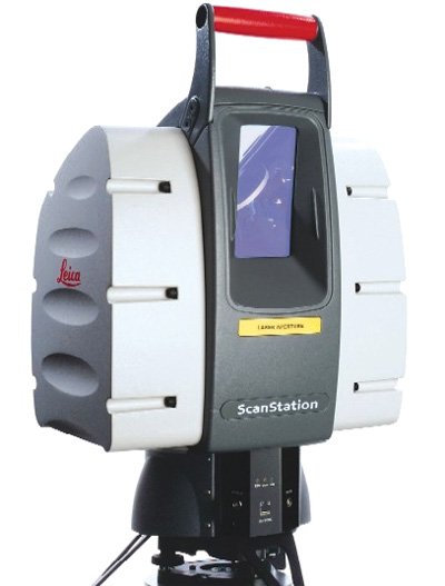
A range of highly advanced core technologies – EDM (Electronic Distance Measurement), GPS technology, 3D laser scanning, tilt and angle and point-cloud generation and analysis – are applied to the needs of a wide range of industries. The resulting comprehensive portfolio of products and services, coupled with a dedication to customer service and support, generates innovative solutions that open up new opportunities for their customers’ growth.
In a complex world, Leica Geosystems customers measure success in many different ways. Because every project is different, none is routine and all are important.
Leica Geosystems customers are active across a wide spectrum of industries. And what these customers measure is equally diverse. Sometimes it’s a single point: a height above sea level, the distance from one wall to the other. Sometimes, many points are involved, as complex objects are positioned and assembled with micron-level precision, or the entire face of a building is scanned into a three-dimensional drawing. And sometimes, a complete image must be captured and analysed, to create accurate maps, multilevel representations and 3D fly-throug
models.
Like no other company, Leica Geosystems offers solutions for all these needs. From an architect calculating how much paint is required, to an engineer designing a bridge, to a surveyor optimising wireless phone tower coverage, Leica Geosystems’ solutions encompass a workflow that transforms raw data into useful information, turning measurements into maps, and maps into models that capture the real world. With the broadest range of competencies within the Surveying, Civil Engineering and Construction industries, Leica Geosystems delivers a comprehensive range of products that work together in a complete, endto- end workflow.
Systems that integrate and operate consistently allow customers to work faster, more efficiently and more productively. Not every Leica Geosystems customer operates across the entire workflow; many have specialised needs within one phase. But all benefit from the depth of Leicia’s research, and the commitment to each other’s success. Its customers recognise the advantage of sourcing solutions from a single supplier who can meet their needs – both today and tomorrow, as demands change, business expands, and activities grow more complex.
Working together with these professionals and their distribution partners, Lecia solves problems, develops new ideas and invents new technologies. It is this collaboration which ultimately shapes Leica Geosystems products and services, drives its customers’ businesses, and improves the world in which we live.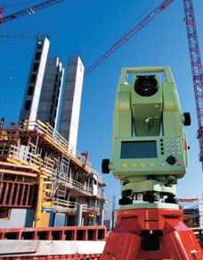
Leica Geosystems is committed to understanding its customers’ needs – and to exceeding their expectations. Increasingly, geospatial solutions encompass more than products, hardware or software: today’s customers demand comprehensive solutions that include an extensive range of services, too.
Many companies have been Leica Geosystems customers for decades. In fact, the typical Leica Geosystems user is fiercely loyal, and reluctant to use alternatives. What lies behind this loyalty is an appreciation of the significant role customer service and support play in the success of every project. Lecia’s customers trust it to keep their equipment up and running all the time. Not that support means dependence – increasingly, Lecia’s offerings empower its customers to execute processes themselves which they traditionally outsourced. And along with support for all of its own products, Leica Geosystems is also a recognised leader in support for a wide range of third-party geospatial software products.
Leica Geosystems has established an enviable reputation for the quality of its products, and are constantly investing to maintain this leadership position. It has never sought to be the least expensive; rather, it strives to deliver the maximum value over the life of its products. Leica Geosystems customers understand the difference – and recognising the importance of consistent, accurate measurement, they choose them for reliable results and dependable service every time.
Leica Geosystems has repeatedly revolutionised the science and technology of geospatial information. This unparalleled commitment to research and innovation is reflected in its history of ‘firsts’:
- 1921 World’s first portable opto mechanical theodolite
- 1925 First aerial photography camera
- 1969 First infrared-based distancer
- 1984 First GPS for surveying
- 1991 First industrial laser tracker
- 1993 World’s first handheld laser distance meter
- 2004 First universal GPS/TPS surveying system and the world’s first mobile CMM – the Leica T Probe and T-Scan
- 2005 World’s first total measurement station with integrated GPS, the Leica SmartStation.
In total, Leica Geosystems holds more than 1000 patents, many of them registered in the past decade.
Leica Geosystems’ commitments to innovation and quality have a single goal: understanding and supporting the customer’s workflow. The result is a product portfolio, a service offering and a comprehensive range of solutions that are unique in the market. In turn, these customers have rewarded Leica Geosystems with their trust.
From its start, in a small Swiss town almost two centuries ago, Leica Geosystems has established a tradition of quality, innovation and dedication to customer satisfaction.
International and Swiss at the same time, Leica Geosystems today is a global enterprise with more than 2400 employees serving customers in some 120 countries. Those customers tell them they continue to work with Leica Geosystems because of the truly exceptional support and service. It’s a concept Leica Geosystems call Active Customer Care: a true partnership, a commitment to fulfilling the trust
customers place in them. From education and training, through ongoing support, and assistance in keeping equipment in top condition – around the clock and around the globe, Leica Geosystems and its partners guarantee productivity and performance.
Leica Geosystems is proud of its people. A highly educated, unusually talented team spans the globe, dedicated to customer success and committed to excellence. Whether you are building a house or a bridge, a map or an aircraft, you need reliable
measurements. So when it has to be right, professionals trust Leica Geosystems to help them collect, analyse, and present spatial information. With close to 200 years of pioneering solutions to measure the world, Leica Geosystems is best known for its broad array of products that capture data accurately, model quickly, analyse easily, and visualise and present spatial information even in 3D. Those who use Leica products every day trust them for their dependability, the value they deliver and the superior customer support.